September 8, 2025
Mountain Weather Forecasts from the Experts: Cutting Temperature Prediction Errors on Mt. Fuji by About 50%
Since the COVID-19 pandemic, interest in outdoor activities has surged, and more people are taking up mountain climbing. At the same time, the number of mountain accidents has been rising for three consecutive years since 2020, with nearly 3,000 incidents reported in 2024.
One major factor behind mountain accidents is deteriorating weather, which can lead to climbers getting lost or slipping. Japan’s National Police Agency has urged climbers to check weather conditions, make safe climbing plans, and keep up with the latest forecasts to prevent such accidents1.
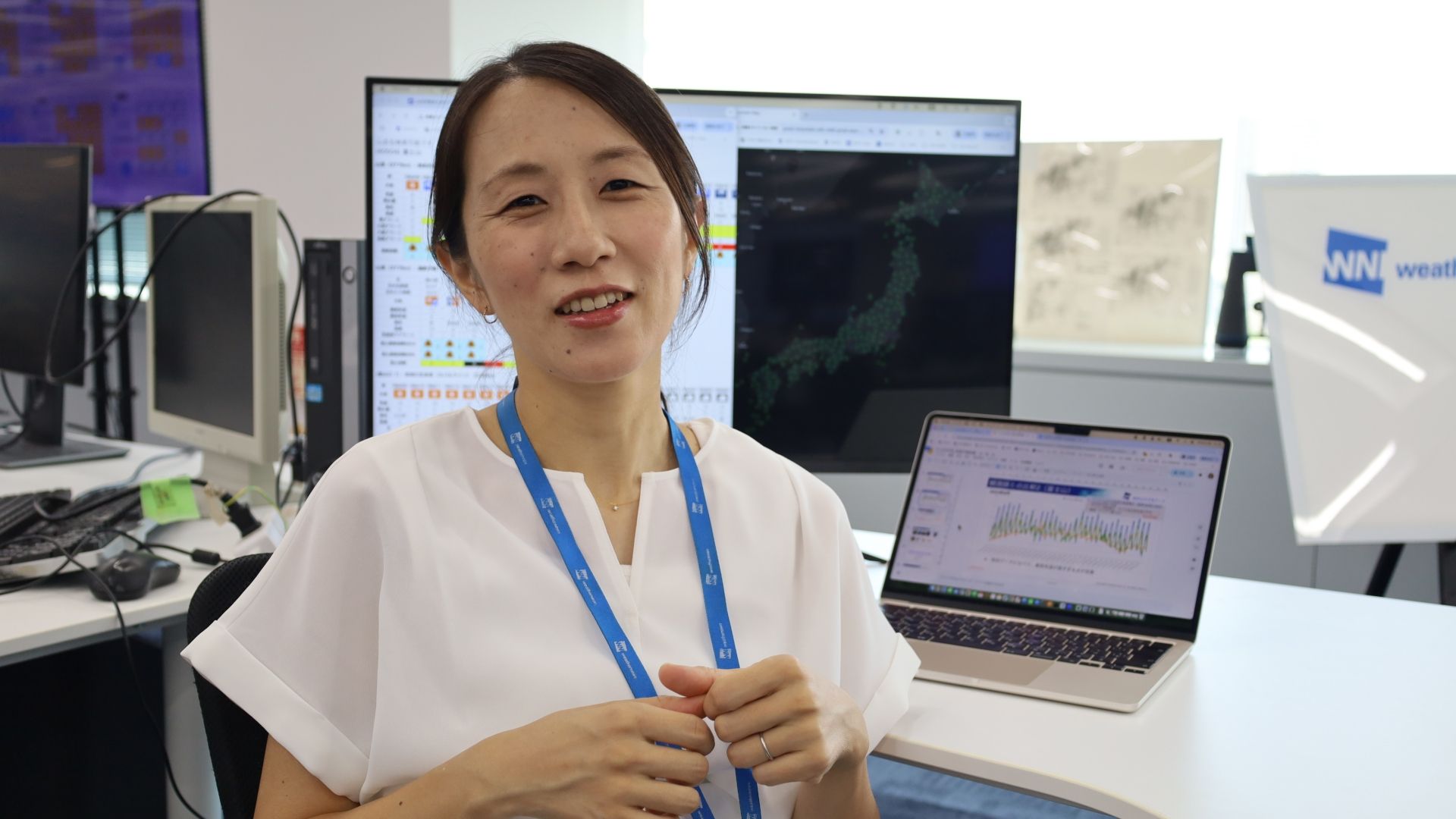
Many Weathernews staff members are avid mountain climbers themselves. But how do professional meteorologists use weather information when climbing? We spoke with Ayumi Kusada from the Weathernews Forecast Center, who develops our "Mountain Forecast" service. She shared insights about her own climbing experience, the origins of our mountain forecast content, and the service's first major update in ten years.
Checking the Latest Data Before a Climb, "Sora Yomi" While Climbing
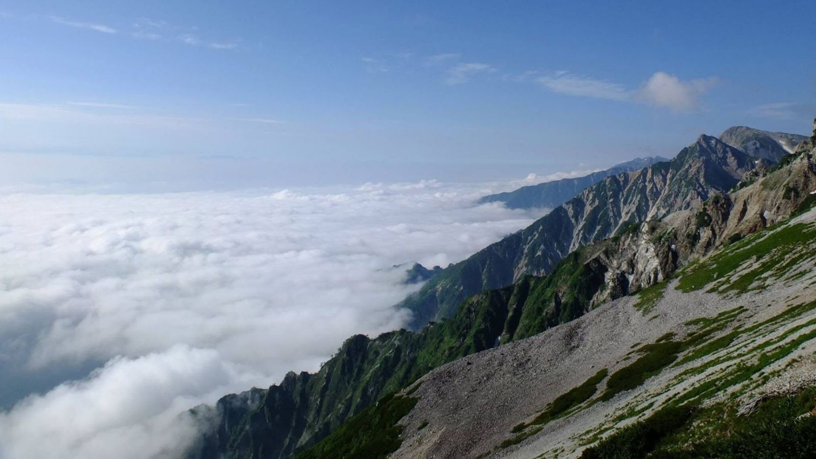
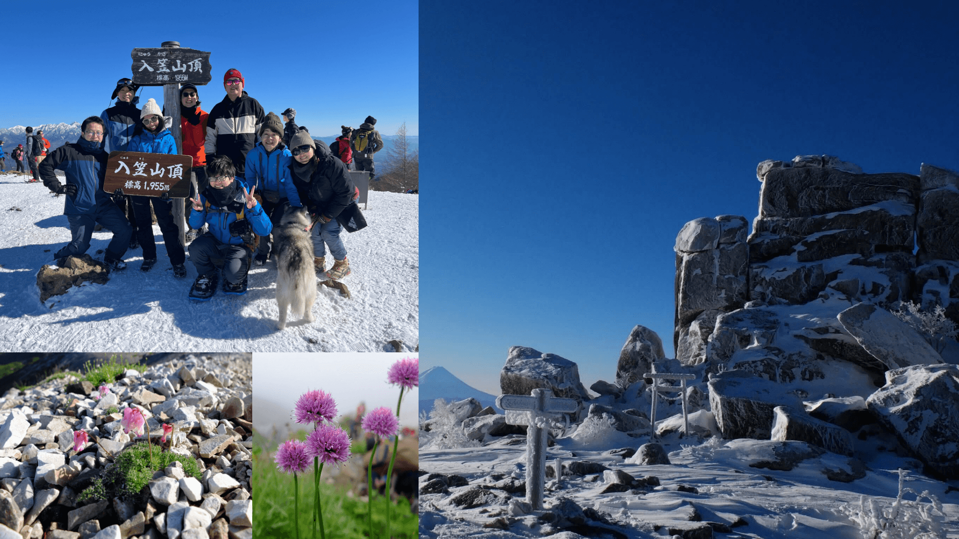
The appeal of mountain climbing is the sense of unity with vast natural landscapes, but mountain weather changes quickly and can be dangerous. Mountain climbing is my hobby andI go as often as once every two months. For safety, I always check weather data when planning a climb.
During preparation, I look at temperature and wind to decide what gear to pack, such as rainwear or warm clothing. Ideally, I plan climbs when a mobile high-pressure system is approaching, which usually means stable weather. If the forecast still looks bad the day before, I cancel or change my destination.
While climbing, I continue to check weather information. Since signal is often available near trailheads and mountain huts, I take screenshots of forecasts in case reception drops. I also practice “Sora Yomi”, a Weathernews expression meaning to read the sky and sense changes directly. One time, while approaching a hut, I suddenly heard thunder rumbling and quickly hurried to shelter.
Today, many organizations publish mountain-specific weather forecasts, but not long ago, only general forecasts were available,only data suited for lowland daily life and for high-altitude climbing.
Cutting Temperature Prediction Errors by About 50%: A Forecast Built by Mountain Lovers
I still vividly remember when, 10 years ago, Weathernews decided to launch mountain-specific forecasts on a separate app and I was invited to join the project.
One day I was talking with Iijima, our in-house expert on mountain meteorology, and we discovered that his college town and my hometown were very close. We joked that we might have crossed paths before. Both of us loved mountains, and our conversation flowed easily. Around that time, other mountain-loving colleagues were also saying, “We need content for climbers, so let's make it!” That momentum pushed us to develop a service based on the real experiences of climbers on our team.
Now, 10 years later, we have relaunched mountain content inside the Weathernews app. Old members and new mountain enthusiasts alike came together, discussing how to create “the kind of content we ourselves would want.” Working again with such passionate teammates was both rewarding and deeply moving.
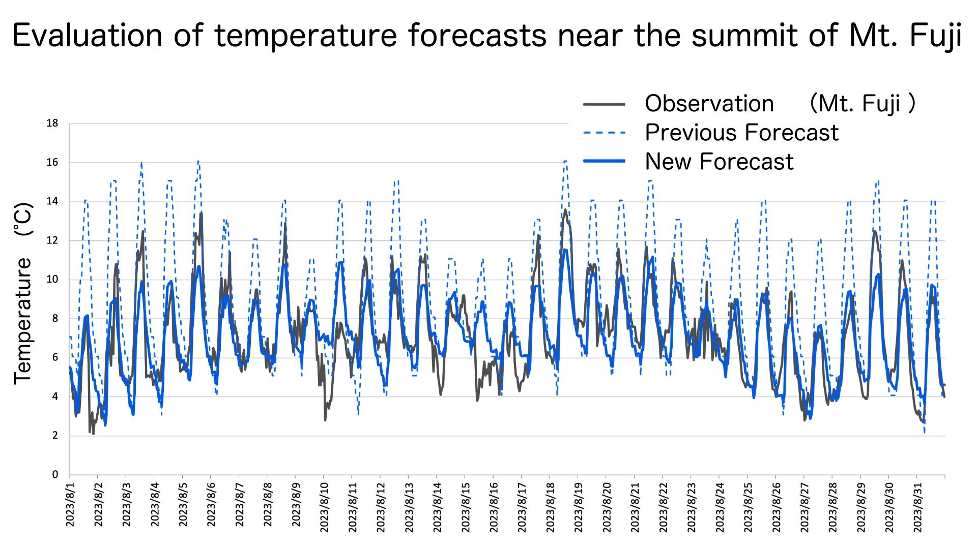
This time, I focused on overhauling the “Mountain Forecast” logic to improve accuracy. Traditionally, mountain temperatures are estimated using the lapse rate rule: for every 100 meters in elevation, the air cools by 0.6°C. But this overestimates daily temperature swings. We tried altitude-based forecast data, but it failed to reflect surface influences like daytime heating and nighttime cooling. So we combined both methods by taking altitude-based model data and correcting it using observed data from the mountain's base.By integrating 8 different models, we developed a new, more reliable forecasting method. Before release, we tested its accuracy on Mt. Fuji’s summit. Using RMSE (Root Mean Square Error), we found errors decreased from 4.36 to 2.65 (42% reduction) year-round, and from 3.23 to 1.68 (48% reduction) during the July–August climbing season.
Improving Wind Forecasts: Realistic High-Resolution Expressions of Mountain Terrain
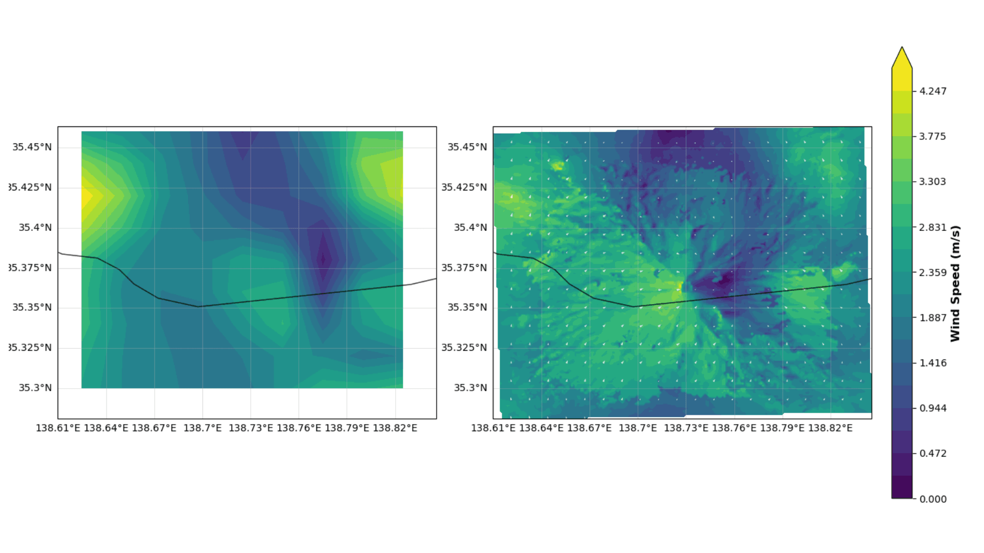
Previously, forecasts relied on upper-level wind speeds, which tended to exaggerate actual strength. We created a new logic that factors in friction and terrain effects. Though I can’t disclose the exact formulas, we experimented extensively with calculations and coefficients. Across eight representative mountain areas, wind forecast errors dropped by about 40%.
For wind, we also improved presentation. Our “Mountain Radar” feature provides hourly wind direction and speed forecasts up to 65 hours ahead, with a resolution of 100 meters. By accounting for slopes and terrain features, forecasts are not only more accurate but also more realistic which helpsclimbers better understand risks.
Bringing Safety to the Mountains with Advanced Forecasting
Safer Mountain Climbing with State-of-the-Art Forecasts
Since releasing the new forecasts2, many of my mountain-climbing colleagues have told me, “That new content is great!” Hearing that makes me happy, and I plan to use it myself on future climbs to keep improving it.
Our mission is to harness the latest forecasting technology to help more climbers enjoy mountains safely. At Weathernews, we constantly gather global meteorological data and the latest research findings. As AI and computing power evolve rapidly, forecasting technologies continue to advance.
This update is one outcome of those advances. Looking ahead, we aim to refine our logic with even more data, to deliver forecasts that communicate mountain risks with greater accuracy and clarity.
We want safe climbing to become the norm. To achieve that, we’ll keep challenging ourselves.
Footnotes
Share
March 13, 2026
How TV Stations Are Transforming Weather Coverage A New Content Solution Helping Broadcasters Navigate Weather and Disaster Reporting
March 6, 2026
Weathernews Launches Comprehensive BCP Service: Emergency Confirmation Powered by Weather Expertise

March 6, 2026
Taking on Japan's Most Widespread Health Challenge with Data and Passion: Why Weathernews Continues to Strengthen Its Pollen Information and the Commitment Behind It