July 20, 2025
AI Predicts Torrential Rain Occurrence :2,500 Cameras Monitor Sudden Weather Changes

In Japan, torrential rains occur almost daily across the nation from July to September, with approximately 79,000 incidents recorded nationwide last year. At Weathernews, following a series of flood-related accidents caused by torrential rain in e2008, we established a specialized team with the mission of reducing damage from torrential rain, even if only slightly, and have been working to predict these sudden storms.
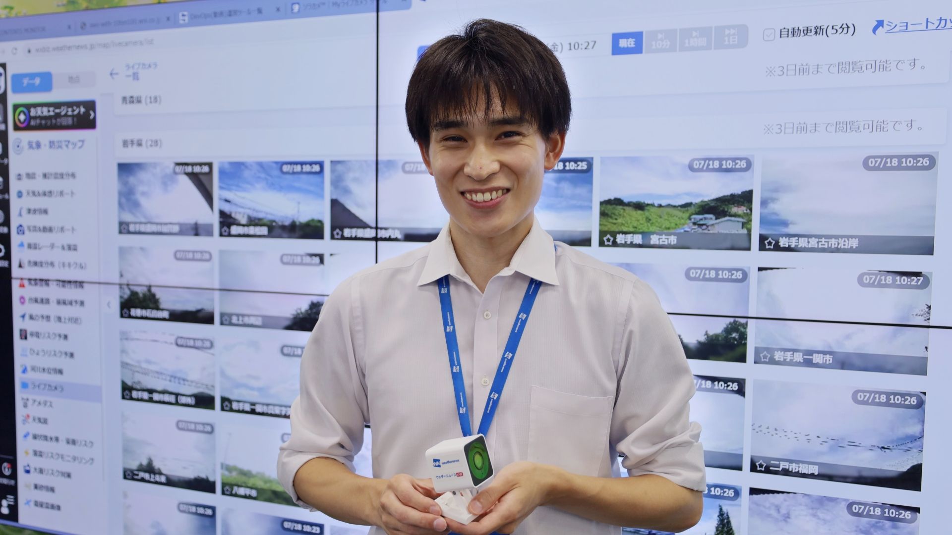
We spoke with Fumiya Kimura, who leads the development of AI analysis technology that assesses torrential rain risk from camera images.
Building a Stronger Live Camera Network: Installations Grew Fivefold in One Year
At Weathernews, through our weather app Weathernews, which has been downloaded 48 million times, receives reports of sky images, videos, and weather observations from users. We use up to 200,000 pieces of this data daily for forecasting—a unique approach we've been implementing.
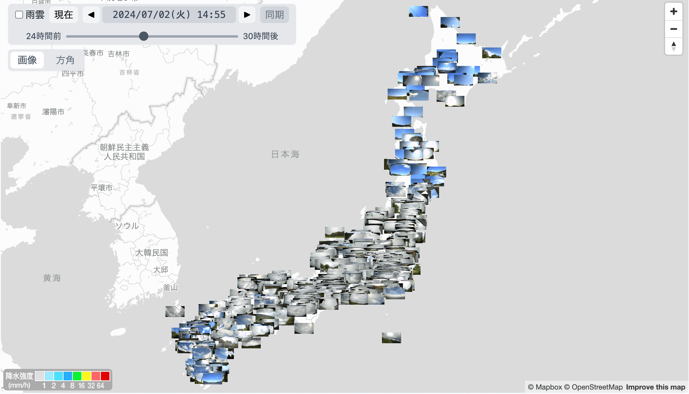
As part of this effort, we began a collaboration with Soracom's cloud-based camera service 'sorakame' in 2024 to strengthen our live camera network. 'sorakame' cameras are given as gifts to Weathernews app users and are also sold through the Weathernews online shop. Users install them outdoors on balconies and in their gardens at home. The footage from 'sorakame' can be viewed through the app and is also featured when we showcase sky conditions from across the country on our weather information program 'weathernews LiVE.'
This initiative has received tremendous support from users, and we have now surpassed 2,500 publicly available camera locations nationwide. In just over a year since launching this effort, our nationwide live camera network has grown more than fivefold—spreading at an incredible pace.
*“ソラカメ“(Sorakame)is a trademark or registered trademark of SORACOM, INC.
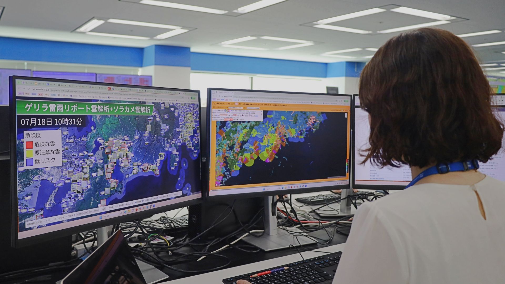
AI Analyzes Images from Compact Web Camera "sorakame" to Assess Torrential Rain Risk at Three Levels
With our impressive network of 2,500 locations nationwide, we receive 'sorakame' data every minute, which means we acquire 2.88 million images per day. Our torrential rain specialist team wanted to transform this vast amount of data into better forecasts for users, so we decided to take on the challenge of predicting torrential rain using live cameras. Torrential rains, which cause increasing damage from the rainy season through the end of summer, differ from rain caused by fronts or low-pressure systems—they occur when cumulonimbus clouds develop rapidly. Therefore, the time from cloud development to damage is extremely short, and there are many cases where countermeasures cannot be implemented in time after conventional observation equipment detects precipitation. However, live cameras can capture and monitor real-time data on cloud color, shape, and size, allowing us to detect visual signs that rain is approaching—something we thought could be effectively utilized for torrential rain prediction.

The data received from 'sorakame' is analyzed by AI, which examines the brightness and color of clouds to assess the likelihood of development into torrential rain. We then classify the possibility of torrential rain occurrence into three levels: 'Low Possibility,' 'Caution Required,' and 'Dangerous,' displaying these on the system used by torrential rain specialists at our forecast center.
During initial development, we faced the challenge of inconsistent sky analysis accuracy depending on camera angles. However, by using AI, we became able to accurately recognize the boundary between buildings and sky, excluding building portions from our analysis, which dramatically improved prediction accuracy.
With conventional rain detection using observation equipment alone, or manual monitoring of 2,500 cameras, it would be difficult to accurately assess torrential rain risks. However, the ability to quickly evaluate sky conditions through AI has been extremely helpful in detecting developing rain clouds without missing them, making it possible to provide slightly longer warning times before rain begins.
Going forward, we plan to enhance the sophistication and efficiency of torrential rain prediction by further improving image analysis technology accuracy and focusing our analysis on areas with higher torrential rain risk.
Toward Technology That Can Analyze Weather Risks with Any Camera Worldwide
While we initially developed this technology for internal use, we ultimately want to make this system applicable to any camera worldwide. For example, in Japan, torrential rain prediction is essential for local governments, companies, and those working in disaster prevention, but field personnel are not necessarily weather experts. If we can use the technology developed by us weather professionals to utilize existing camera images for torrential rain prediction, we can provide slightly longer warning times and enable countermeasures to be implemented.
Weather phenomenon analysis using cameras is not limited to torrential rain. For example, if AI can be used to analyze various weather phenomena such as fog, where there are few measurement opportunities with observation equipment, this would lead to enhanced situational awareness and improved forecast accuracy. We will continue to pursue AI-powered weather phenomenon analysis going forward.
Introducing the Forecasting Field! Collaborative Efforts with Users to Create Torrential Rain Forecasts

Weathernews' torrential rain specialist team operates a system that quickly captures signs of torrential rain based on suspicious cloud reports submitted by supporters and applies this information to forecasting, operating as follows: (1) The forecast center requests cloud monitoring from areas with potential for torrential rain (2) Users who receive the request monitor clouds and send reports as soon as they discover suspicious clouds (3) Cloud reports received at headquarters are analyzed in combination with various meteorological observation data including proprietary radar and satellite imagery, as well as proprietary algorithms (4) When headquarters determines that the possibility of torrential rain occurrence has increased, advance notification of torrential rain occurrence is sent to "Torrential Rain Alarm" subscribers
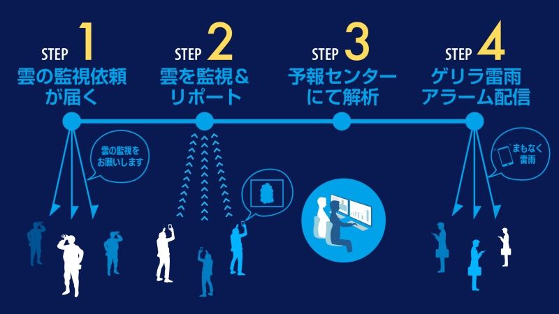
This is how Weathernews' forecast center predicts daily torrential rain events. By analyzing weather observations, sensory reports, wind data, and other meteorological information in combination, we can quickly detect signs of torrential rain, which is considered difficult to predict with conventional weather forecasting. If torrential rain is likely to occur within approximately one hour, alert notifications are sent to users registered for the "Torrential Rain Alarm" notification service. We will continue to monitor the sky together with app users and work to minimize damage from torrential rain.
Share
![[Developer Interview] Building the World’s Most Accurate Wave Forecasting Model](https://gvs.weathernews.jp/wni_blog_media/large_20260331_TOP_177db7c4c9.JPG)
April 1, 2026
[Developer Interview] Building the World’s Most Accurate Wave Forecasting Model
April 1, 2026
Enhancing Safety for Vessels and Coastal Operations with a Weather IoT Sensor You Can Deploy Anywhere: Enabling Hyper-Local AI Forecasting in Ports
March 27, 2026
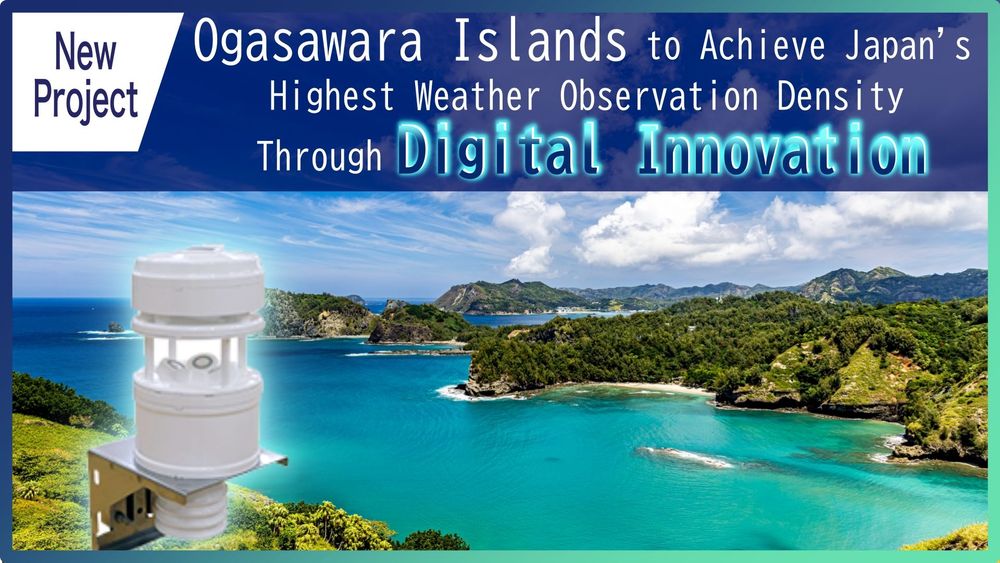
Ogasawara Islands to Achieve Japan's Highest Weather Observation Density Through Digital Innovation