News & Press Release
Real-Time Detection of Volcanic Eruptions Using AI Image Analysis Technology
Full-Scale Operation of AI Volcanic Ash Detection System for Aviation Market Begins
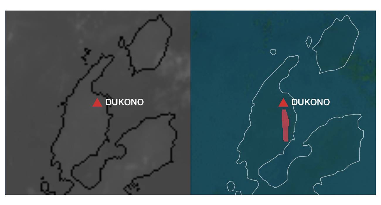
Recognition of volcanic smoke through satellite imagery immediately following volcanic eruption
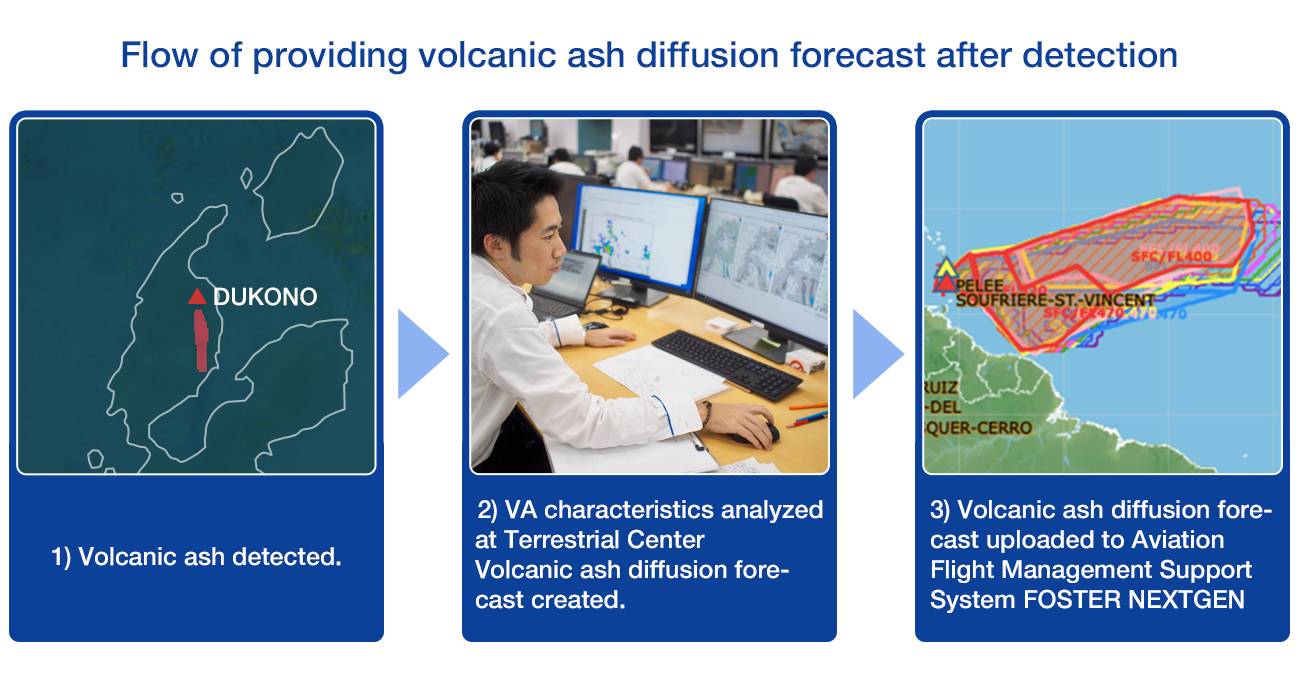
Aviation >Weathernews Inc. has commenced operation of an "AI volcanic ash detection system" that detects volcanic eruptions using proprietary AI image analysis technology. This system is the first in the world that uses satellite imagery to detect eruptions and track volcanic ash cloud movements in real-time using AI. By introducing it into the volcanic ash diffusion prediction methods employed by the Weathernews Terrestrial Center for airlines, it will be possible to detect small-scale eruptions that were previously difficult to detect. Weathernews Inc. will contribute further to the safety of the aviation industry by providing real-time eruption information to airlines operating near volcanoes.
World's First AI Technology to Automatically Recognize Volcanic Ash Clouds
Many experts, including the Terrestrial Center in our company, are currently using satellite imagery to detect and monitor volcanic ash clouds from active volcanoes around the world. However, in the case of small-scale eruptions, volcanic ash clouds are often overshadowed by clouds from the viewpoint of satellites, and it does not erupt frequently, making it difficult to notice eruptions in areas that are not monitored. For this reason, our company has developed an AI volcanic ash detection system that uses its own AI image analysis technology to recognize images of volcanic eruptions and volcanic ash clouds. This system has been put into full operation at our Terrestrial Center. This system is the first in the world to be capable of real-time image recognition of volcanic ash clouds from gaps in clouds using AI, using satellite images that overlook the entire earth. AI image analysis technology uses modeling to distinguish subtle differences between clouds and volcanic ash clouds, such as shape and texture. By using this system, even small eruptions that were previously difficult to detect can be detected more quickly and accurately from between clouds, and volcanic ash diffusion can be predicted more quickly.
In the future, we will further evaluate and improve the accuracy of smoke detection in small to large-scale eruptions. In addition to satellite images, the system will also detect images from our company's own live cameras installed near the volcano, and will also provide predictions on the spread of volcanic smoke in real time.
ACOS service monitors volcanoes around the world and helps aircraft operate safely
Smoke from volcanic eruptions can endanger aircraft flight, causing poor visibility and damage to aircraft and engines. In 2010, Iceland's Eyjafjallajokull glacier erupted, forcing the closure of airports in about 30 countries and forcing the cancellation of many flights.
Taking this opportunity, our company has started to provide its own volcanic ash detection and diffusion prediction service (ACOS) for the aviation market. This service is a unique service of our company that monitors volcanoes all over the world and quickly provides its own diffusion prediction when an eruption occurs. They are quick to announce where the volcano erupted, how the volcanic ash cloud flows, its scale and the arrival time. Currently, it is offered mainly to airlines operating in Japan and Southeast Asia where there are many active volcanoes.
Airlines make their flight decisions based on information released by public agencies, but this service can also be used as reference information, and it will be possible to consider measures such as changing flight plans and notifying aircraft on the route more quickly.
Click here to download PDF