News & Press Release
The First Images from Weathernews Proprietary Weather Satellite WNISAT-1R
First photo from Arctic Ocean; Fully Operational in September
Shipping >Weathernews Inc. (Chiba, Japan; CEO: Chihito Kusabiraki) and Axelspace Corporation (Chuo-ku, Tokyo; CEO: Yuya Nakamura) have announced the successful receipt of the first images from the jointly-developed WNISAT-1R, a proprietary microsatellite designed to observe weather and ocean phenomena and launched on July 14, 2017. Currently the satellite is undergoing testing in order to determine its present condition, and preparations continue toward going operational in September 2017.
WNISAT-1R Marks Successful First Light with an Image of Sea Ice over the Arctic Ocean
WNISAT-1R was launched aboard the Soyuz rocket from the Baikonur Cosmodrome on July 14th at 3:36 PM JST. Successful transmission of its initial images (first light) was confirmed on July 25th and 4:45 AM JST. Preparations such as the calibration of photographic parameters and analysis algorithms continue before the official start of sea ice observations. The image was received based on the results of joint research and development by Weathernews Inc., Axelspace Corporation and the Tokai University Research & Information Center.
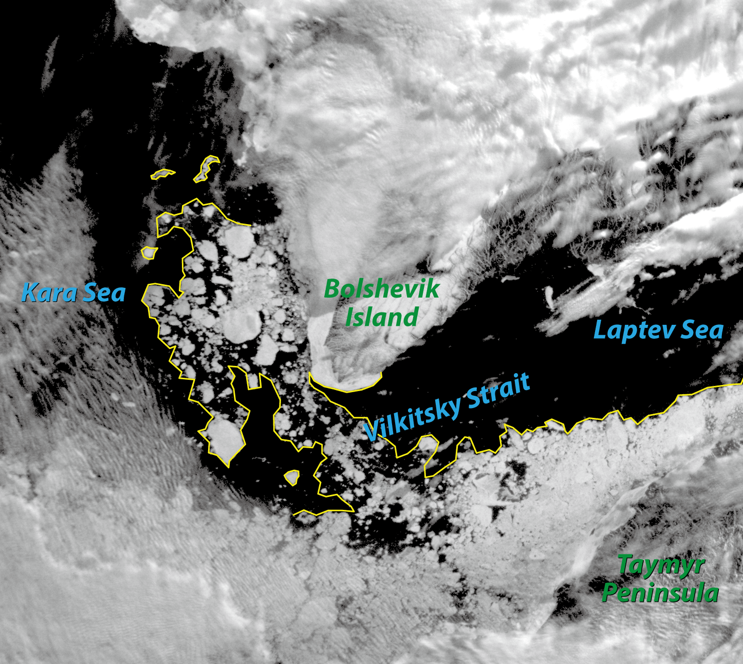
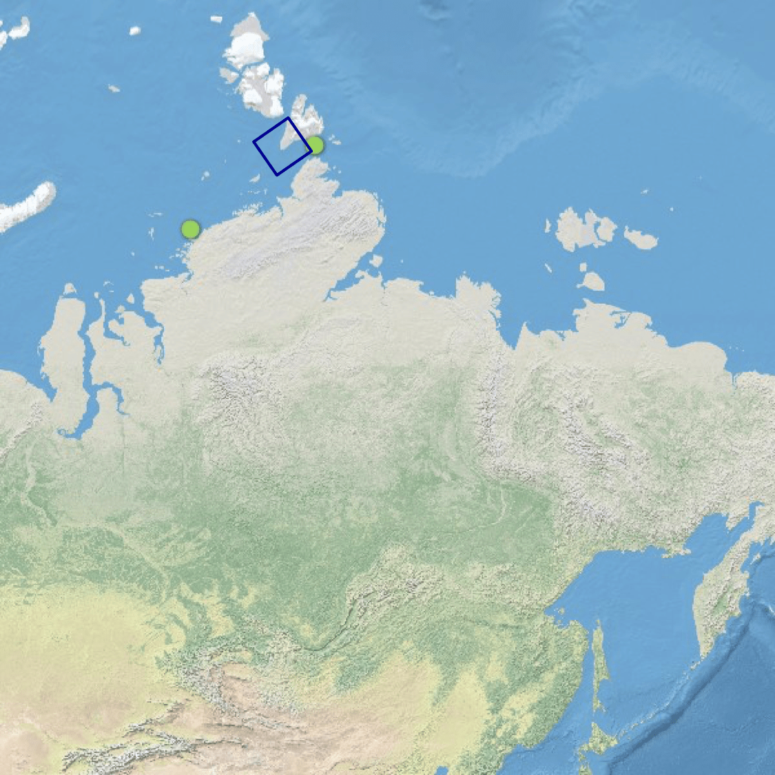
Time: Jul 25, 04:45; Location: Vilkitsky Strait
The Mission of WNISAT-1R
WNISAT-1R was developed in conjunction with Axelspace Corporation, weighs a mere 43kg and will orbit the earth for five years at an altitude of 600km. It has three visible channel cameras (red, green, panchromatic) and one near-infrared camera on board. Compared with similar satellites, the camera resolution is about 20% higher, and by setting the time and scope, it is possible to get data for the desired timing and area. Weathernews will also use optical cameras to take experimental observations of sea ice, tropical cyclones and volcanic eruptions in order to improve the accuracy of the weather forecasts as well as to enhance service to marine and aviation customers.
The most important part of the mission of WNISAT-1R is to take observations over the data-scarce Arctic region. In recent years, Russian LNG development projects have become more active, and the Northern Sea Route is expected to be utilized for the transportation of construction materials and modules from the Far East and transportation of LNG after production commences, resulting in heightened needs for high-precision sea ice information for safe navigation. However, at present there is a dearth of data over the Arctic Ocean. By matching the observations with the voyage timing through icy areas, such as the Arctic Ocean in the summer, or the Bohai Sea and Gulf of St. Lawrence in the winter, and combining them with other observational and analyzed data in addition to data from other weather satellites, we will confirm with the shipping industry how we will be able to contribute to even safer voyages.
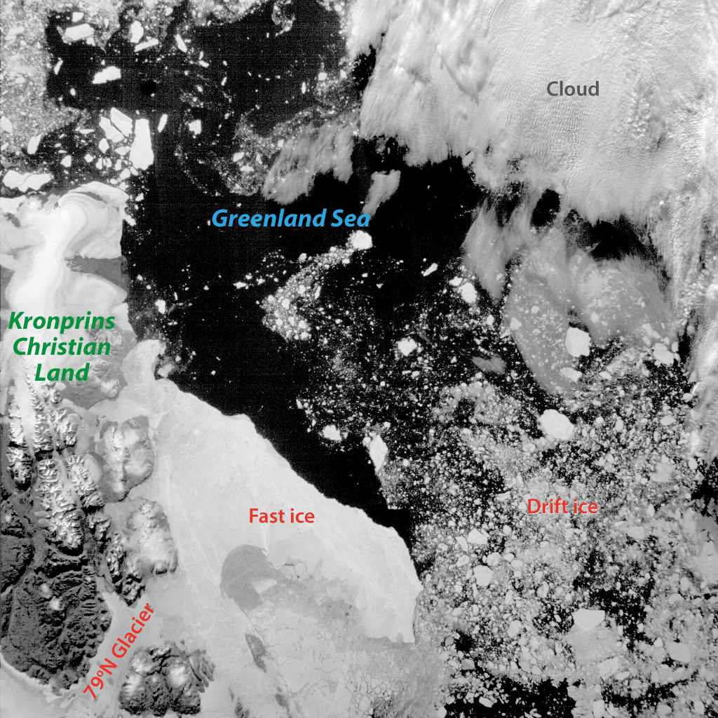
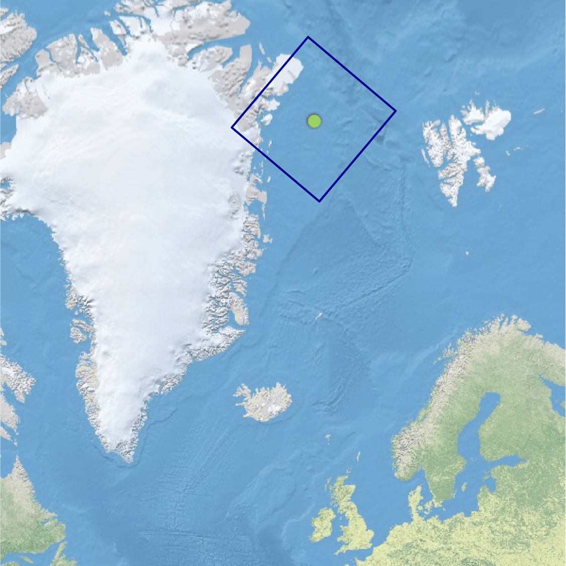
Time: Aug 1, 12:20; Location: Greenland
In addition, support for aircraft is also within the scope of our vision for WNISAT-1R, for which optical cameras will be used to make experimental observations of tropical cyclones and volcanic ash. In addition to taking images of the scope of the cyclones or the dispersion conditions of the volcanic ash, utilization of stereographic photography will allow the heights of cloud tops and ash plumes to also be measured. By being able to accurately measure cloud top heights, aircraft will be able to consider other options such as flying over cumulonimbus clouds, rather then just the traditional method of flying around them. In addition, by being able to accurately assess the height of ash plumes, it will become possible to improve accuracy of dispersion forecasts of volcanic ash, which can have adverse effects on aircraft engines, thus assisting in safety enhancements.
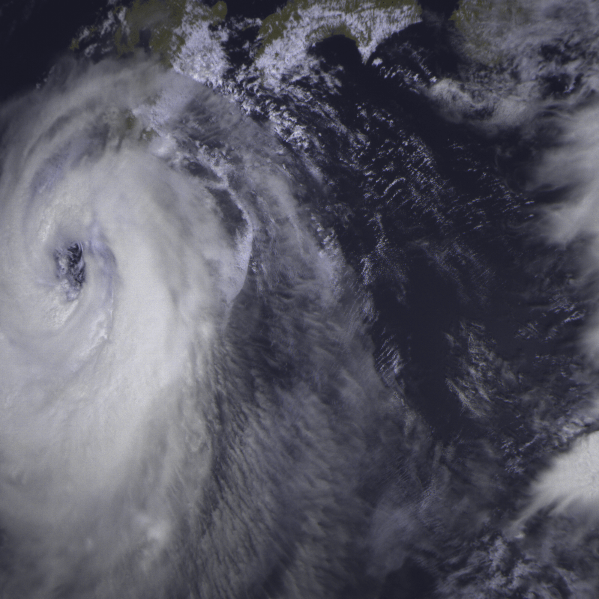

Time: Aug 5, 11:04; Location: Kyushu and Shikoku