News & Press Release
Weathernews Second Microsatellite, WNISAT-1R, Successfully Launched
Mission for Risk Communication Services; Monitoring the Oceans and Atmosphere
Shipping >Weathernews, Inc. (Chiba, Japan; CEO: Chihito Kusabiraki) announced that the second microsatellite, WNISAT-1R, was successfully launched at 15:36 (JST) on July 14th on the Soyuz rocket from the Baikonur Cosmodrome in Kazakhstan and injected into the planned orbit. It was confirmed as alive through signals received as it passed over Japan (22:24 - 22:36 JST on the 14th).
Launching of the Soyuz
Launch of WNISAT-1R Success Confirmed After Signals Received from the Satellite
WNISAT-1R was launched at 15:36 JST by Soyuz and injected into the planned orbit at 18:05 (JST). The alive signal was received at 22:24 (JST), and successful communication was established. WNISAT-1R was confirmed in good condition and no initial failure has been found.
Status of Operations on Launch Day (July 14)
| Time (JST) | Event |
| 15:36 | Launch from Baikonur Cosmodrome in Kazakhstan |
| 18:05 | WNISAT-1R successfully injected into the planned orbit |
| 19:07 | Successful separation of satellite confirmed |
| 22:13 | Detailed orbit information received |
| 22:24 | Startup test signals received confirming nominal orbit and operational status |

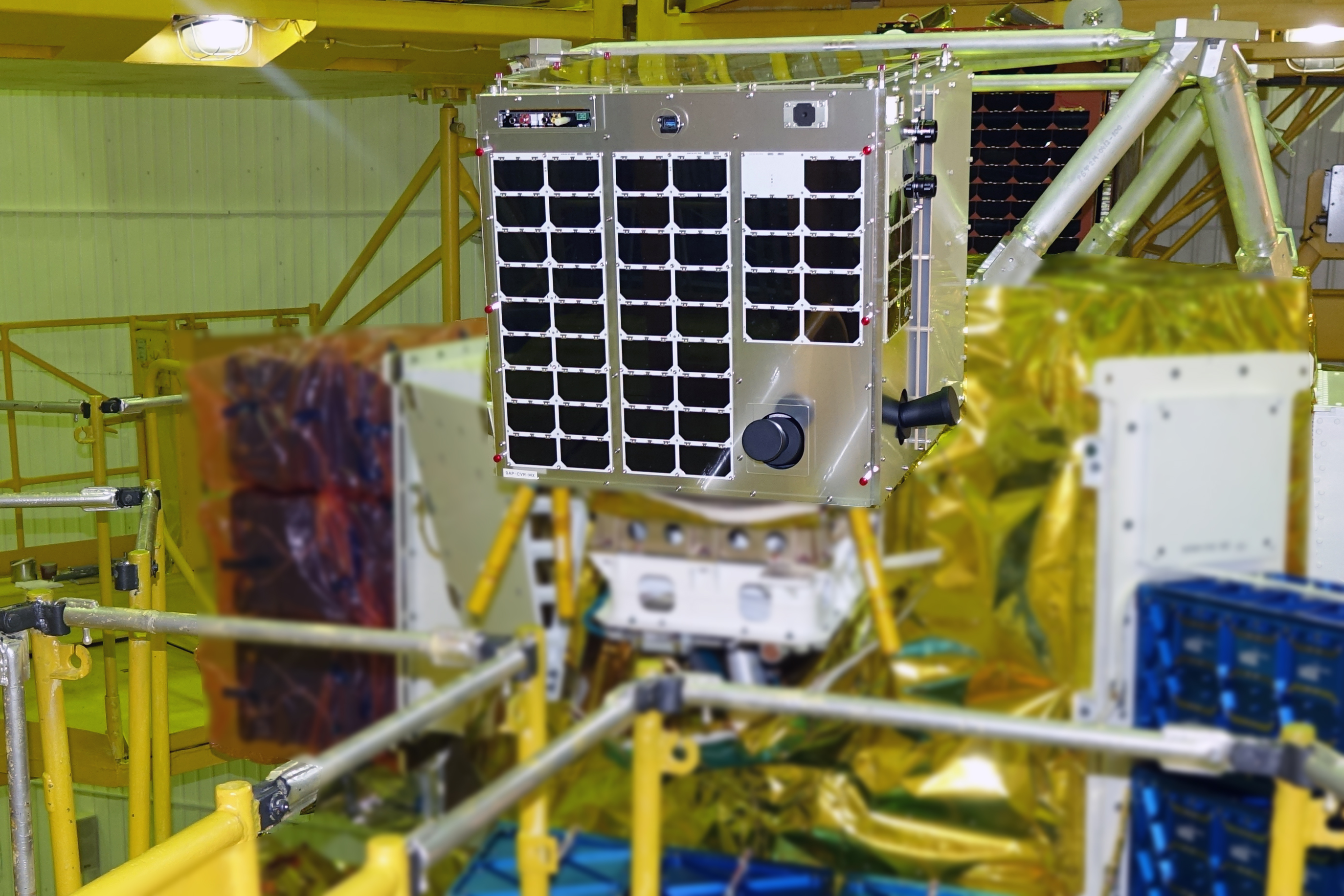
WNISAT-1R Mission Profile
WNISAT-1R is the second satellite, following WNISAT-1 which was launched in November 2013 for observation of sea ice in the Arctic Ocean. It was developed in conjunction with Axelspace Corporation starting in 2014, and completed in September 2015. This was followed by a wait of around two years until the July 2017 launch from Kazakhstan.
Six cameras aboard WNISAT-1R are for the observation of sea ice, which poses a significant threat to shipping, in the Arctic Ocean in summer, and other areas such as the the Bohai Sea, the Gulf of Saint Lawrence, etc., in the winter months. In recent years, Russian LNG development projects have become more active, and the Northern Sea Route is expected to be utilized for the transportation of construction materials and modules from the Far East and transportation of LNG after production commences, resulting in heightened needs for high-precision sea ice information for safe navigation. However, at present, there is very little data on the Arctic Ocean. With the launch of WNISAT-1R, Weathernews will be able to provide more detailed information by using WNISAT-1R to obtain observation data over the necessary areas according to the timing of a voyage, and combining this with the weather satellites currently used for observation.
Weathernews will also conduct experimental GNSS-R observations,(*1) which use the GNSS reflected waves from the globe to observe surface conditions on the earth, and as such are not affected by sunlight and weather conditions. By catching and analyzing the waves reflected back from the surface of the earth, an experimental evaluation of differentiating between sea ice and the sea surface, as well as distribution of sea ice will be carried out. If successful, this method will allow us to observe sea ice even in cloudy conditions and at night.
Furthermore, WNISAT-1R will also be used for monitoring other hazards like typhoons and volcanic ash. Not limited to mere photographic observations of these phenomena, the satellite is in motion, so stereoscopic observations will also allow us to get cloud top heights and the height of volcanic ash after an eruption.
These observations will be utilize in the improvement of accuracy of meteorological and oceanographic analyses and predictions for supporting Weathernews risk communication services.
Basic information on WNISAT-1R
Size | 524 x 524 x 507mm (excluding antenna) |
Weight | 43kg |
Main equipment mounted | 6 cameras - 3 visible channels (red, green, panchromatic) GNSS-R receiver system |
Resolution of images of surface | 400m (near infrared/red), 200m (green/ panchromatic) |
Observation wavelength | Panchromatic(*2) (450-650nm), green (535-607nm) red (620-680nm), near infrared (695-1005nm) |
Attitude control | 3-axis control with the following modes (direction precision: 0.1 degree) Despin(*3), sun oriented, earth oriented, fixed point tracking |
Rocket | Soyuz |
Launch site | Baikonur Cosmodrome, Republic of Kazakhstan |
Orbit | Sun-synchronous orbit (local time of ascending node 11:30), altitude: 600km |
(Note *1) GNSS-R observation: Global Navigation Satellite System-Reflectometry. Method using reflective waves from GNSS satellites such as GPS satellites to observe the state of the earth’s surface.
(Note *2) Panchromatic: Refers to a band sensitive across the entire visible rage of light on the satellite.
(Note *3) Refers to providing a stable attitude by controlling the rotation of the satellite.