News & Press Release
Weathernews' microsatellite, WNISAT-1R to be launched July 14th
Mission of satellite is to monitor global natural phenomena such as sea ice, typhoons, volcanic ash clouds, etc.
Aviation > Shipping >Weathernews Inc. (head office: Mihama-ku Chiba-shi, Japan; CEO: Chihito Kusabiraki) announced that the launch of the WNISAT-1R microsatellite for observing global natural phenomena that affect human activities; sea ice, typhoons, plumes of volcanic ash, etc. is scheduled for July 14th. At present, WNISAT-1R has undergone final operating checks and has been transported to the Baikonur Cosmodrome in Kazakhstan, from where it is to be launched.
WNISAT-1R is the Company’s second satellite, with improved equipment and stronger resistance to radiation, serving as the recovery unit for WNISAT-1 launched in November 2013. Joint development with Axelspace Corporation began in 2014. Development was completed in September 2015 and the Company was waiting for an opportunity to launch the satellite. The launch schedule has been fixed for July 14th on board a Soyuz rocket from the Baikonur Cosmodrome in Kazakhstan. It has been transported to the Baikonur Cosmodrome and is in the stage of waiting for installation into the rocket itself.
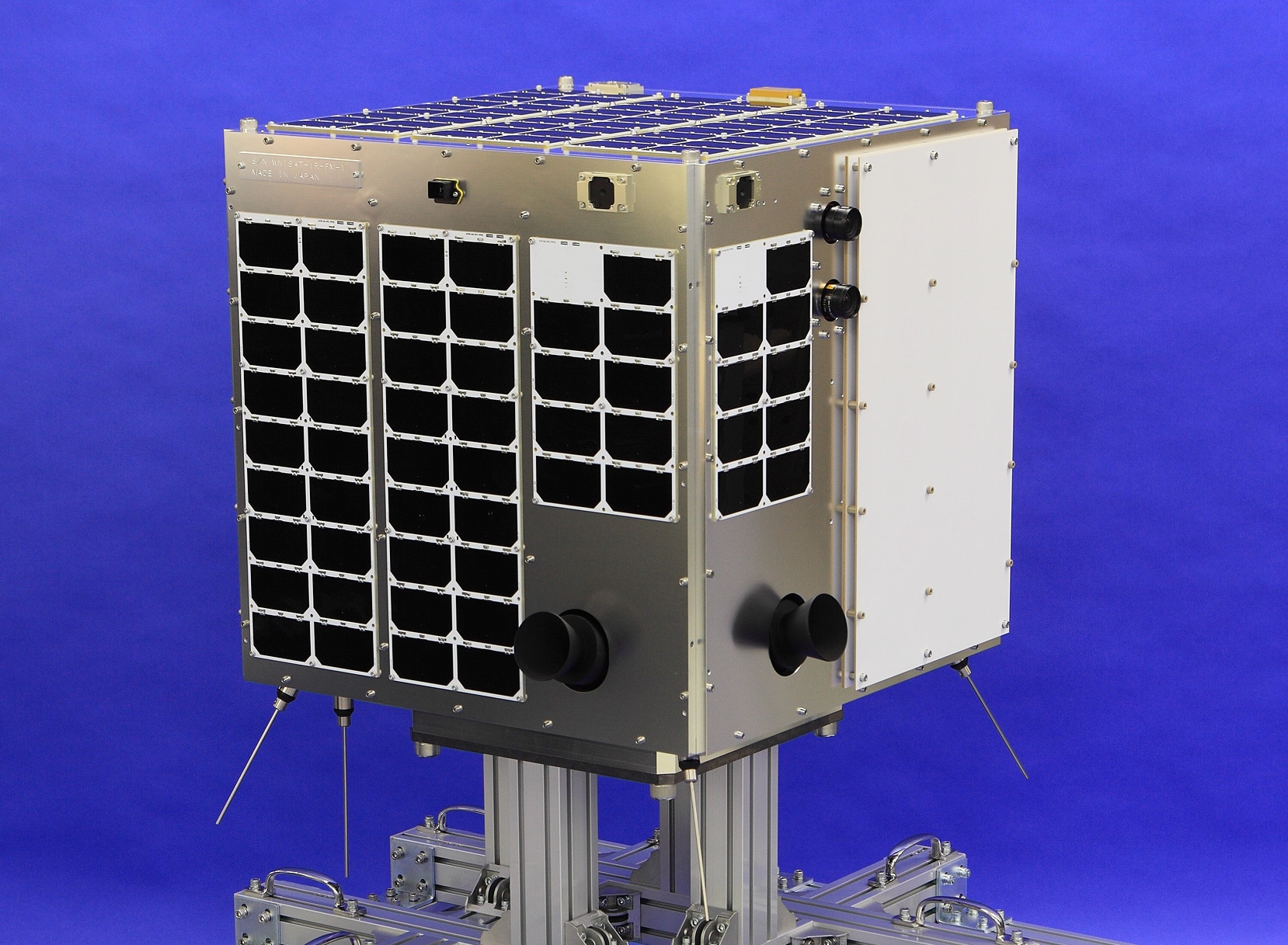
WNISAT-1R is equipped with optical cameras for observing four wavelengths of light (red, green, panchromatic (Note 1) and near-infrared). Using these optical cameras, it will engage in the observation of the extent of sea ice in the Bohai Sea and the Gulf of Saint Lawrence in the winter, and the Arctic Ocean in the summer, which affects the safe passage of vessels. Furthermore, it will observe typhoons as well as ash plumes in the event of volcanic eruptions. It addresses the challenge of not only photographing the spread of typhoons and state of dispersion of volcanic ash, but also 3D observations to identify the height of clouds and the peak of plumes using stereoscopic photography while moving. This observation information will be utilized in the improvement of accuracy of meteorological and hydrographic forecasts, and services for supporting risk communication to the shipping and aviation industries.
Furthermore, it will also use the reflective waves from GNSS to observe the state of the earth’s surface(Note 2) in experimental observations to establish methods of observation that are not dependent on sunlight or weather conditions. Using this method, waves reflected from sea ice and land are received and analyzed to differentiate between sea ice and the sea surface and to provide an evaluation test of the extent of sea ice.
Weathernews will continue to promote the development and use of proprietary satellites in the future to develop new services and improve the precision of forecasts.
(Note 1) GNSS-R observation: Global Navigation Satellite System-Reflectometry. Method using reflective waves from GNSS satellites such as GPS satellites to observe the state of the earth’s surface.
(Note 2) Panchromatic: Refers to a band sensitive across the entire visible rage of light on the satellite.
(Note 3) Refers to providing a stable attitude by controlling the rotation of the satellite.